|
Exploration Story 0-1934
by Tony Higgins
About the year 1000 A..D. Viking voyagers from Iceland established two large settlements in West Greenland, and are known to have used high mountains in East Greenland as landmarks, notably a prominent summit ‘Hvitserk’, which is identified with the Watkins Bjerge (c. 69°N) and Greenland’s highest mountain, Gunnbjørn Fjeld. There is circumstantial evidence of direct contact between the Vikings and the Greenland eskimo population of the Scoresby Sund region, in the form of silver buttons and beads found in Inuit graves. The activities of a few of the most important expeditions that have visited the Scoresby Sund region are summarised below.
1607–1910 Northern whale-fishery
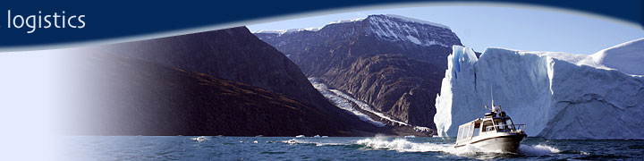
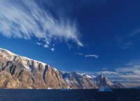
It was Henry Hudson’s 1607 voyage to Spitsbergen and East Greenland that initiated the northern whale fishery. Hudson reported abundant whales in the waters near Spitsbergen, and sighted the East Greenland coast on several occasions between 69° and 74°N. British whalers began to sail to Spitsbergen waters in 1608, and were soon joined by Dutch, French, Danish and Spanish whalers. By 1630 whales had become scarce around Spitsbergen, and whalers began to seek their prey along the edge of the pack ice in East Greenland waters. Sightings of land were reported in whalers logs, but no deliberate attempts to penetrate the ice belt were made until the early 1800s. However, in 1761 a Danish whaler, Volquaart Boon, recorded that his ship was dragged by a strong current into a wide and deep fjord at about 70°20′N, reliably interpreted as being the present day Scoresby Sund. No landings were made, but the name Volquaart Boon Kyst is now applied to the cliffs on the south side of Scoresby Sund.    .jpg)
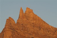
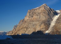
William Scoresby senior and his son (also William Scoresby) had notable success in East Greenland waters, and reported observations of land between 70° and 74°N in their whaling logs in 1817 and 1821. In 1822 Scoresby senior (on the FAME) and Scoresby junior (on the BAFFIN), together with 20 to 30 other British whalers, were on numerous occasions close to land. Scoresby junior named Scoresby Sund after his father, and named many capes and land areas within the Scoresby Sund region after his friends and scientific colleagues; these included Liverpool Land, Jameson Land, Milne Land, Kap Tobin and Kap Brewster. Scoresby junior is noted in particular for his excellent 1822 chart of the East Greenland coast between latitudes 69°–75°N, that corrected the serious errors of longitude of earlier charts, which had placed the coast of East Greenland 7° to 14° too far to the east. Scoresby made landings on the coast at Kap Lister, Neill Klinter, Kap Brewster and Kap Moorsom, the first recorded by European visitors, and described his geological, botanical and zoological observations.
Jules de Blosseville was a French naval officer, who in 1833 had command of the brig LA LILLOISE, and the task of maintaining order amongst the whalers and fishing vessels around Iceland. On July 29th he was close to the Greenland coast between 68° and 69°30′N, and on his return to Iceland sent home a report and sketch map of his discoveries. On August 5th he set sail for the Greenland coast to continue his observations, and vanished without trace with his crew of 80; his ship was apparently wrecked on the barren, inhospitable coast south of Scoresby Sund now known as Blosseville Kyst.
Norwegian sealers made their first appearance in the Greenland Sea in 1847. As whales declined in whales, sealing became increasingly important and reached its heights in the 1850s. The total catch by 40 Norwegian sealers in one season was recorded as 400 000 seals. By the 1890s seals had also become scarce, and many ships made landings on the East Greenland coast to supplement their catch with Walrus, Polar Bear and Muskox.
1891–92 Den østgrønlandske Expedition, led by Carl Ryder
Lieutenant Carl Ryder was appointed leader of an 11-man Danish government-sponsored expedition to East Greenland, which sailed from Copenhagen in early June 1891 aboard the Norwegian sealer HEKLA. The East Greenland coast was reached in the vicinity of Hold with Hope (73°40′N) on July 20th, and the mouth of Scoresby Sund (70°20′N) on July 31st.
After entering Scoresby Sund, a visit was made to Kap Stewart, the site originally planned for the wintering station, but this proved unsuitable. Sailing westwards into the unknown inner reaches of Scoresby Sund, a small enclosed harbour (Hekla Havn) was discovered on Danmark Ø, and became the winter harbour for the expedition and ship.
From Hekla Havn journeys were made by motor boat into Gåsefjord, Føhnfjord, Rødefjord and Nordvestfjord (the first explorations by Europeans), as well as along the coast of Jameson Land. In Spring 1892 sledge journeys were made to Fønfjord, Rødefjord, Rypefjord, Harefjord and Vestfjord. Subsequently journeys were also made to Sydbræ and the inner parts of Gåsefjord. In addition to exploration and mapping of the inner ramifications of the Scoresby Sund fjord system, significant botanical, zoological and geological observations were made.
In August 1892 HEKLA left Hekla Havn, making a stop at Kap Stewart where a depot house (Ryders Depot) was constructed. HEKLA then sailed via Iceland to Ammassalik, and after a short visit returned to Copenhagen.
1899 Swedish East Greenland Expedition, led by Alfred Gabriel Nathorst
A. G. Nathorst led two Arctic expeditions in search of traces of Andrée’s lost balloon expedition, the first in 1898 to Spitzbergen, and the second in 1899 to East Greenland.
The 1899 expedition left Stockholm in May aboard ANTARCTIC, met difficult ice conditions, and reached land at Scoresby Sund (70°20′N) where the head of Hurry Inlet was visited. When ice conditions improved, ANTARCTIC sailed north to the mouth of Kejser Franz Joseph Fjord (73°10′N), and mapped and explored the network of interconnecting fjords and islands that lie in the southern part of the present day North-East Greenland National Park.
1900 Carlsbergfondets Expedition til Øst‑Grønland, led by Georg Carl Amdrup
This was a three-year expedition, but the work of the first two years (1898–1899) was entirely in the Ammassalik region (65°–66°N), and it was only in 1900 that attention was paid to surveying and exploration of the almost unknown coast extending northwards to Scoresby Sund.
Antarctic left Copenhagen in mid‑June 1900 with an 11-man expedition which reached the coast of East Greenland at Lille Pendulum (74°40′N). Turning southwards the expedition reached Kap Dalton (69°25′N) on July 18th, and after building a depot house divided into two parties. Amdrup set off southwards with a crew of three in an 18-foot open boat along the virtually unknown Blosseville Kyst. Ice conditions were more favourable than expected, and the expedition succeeded in making a rough chart of the coast down to Agga Ø (67°22′N). Ammassalik was reached on September 2nd.
Meanwhile, Antarctic with the remainder of the expedition under the leadership of Nikolaj Hartz explored the islands and fjords north of Kap Dalton, finding hot springs, and running aground in Turner Sund. Entering Scoresby Sund, Antarctic sailed to the head of Hurry Inlet where zoological and geological excursions were made inland, and Carlsberg Fjord was discovered. Kap Brewster was visited before Antarctic sailed north along the outer coast of Liverpool Land making several landings and charting further new fjords and valleys. The ship then left the coast for Iceland, prior to fetching Amdrup’s party at Ammassalik. 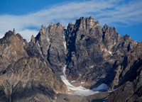   
1924–25 Foundation of Illoqqortoormiit / Scoresbysund
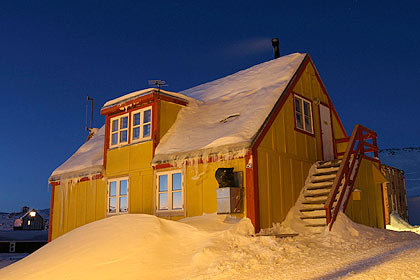
Harald Olrik had proposed the foundation of a settlement in the unpopulated tracts of Scoresby Sund (70°–71°N) in 1911. The project was brought to fruition in 1924 due to the interest and influence of Ejnar Mikkelsen. Grønland left Copenhagen on July 10th laden with building materials and provisions, made an easy passage of the ice belt and arrived off the mouth of Scoresby Sund on July 24th. Materials were unloaded at the site of the present town, and Grønland returned home leaving behind a wintering party of seven, including three carpenteers and three scientists.
A large house was built at the present Illoqqortoormiit / Scoresbysund (the name of the settlement is spelt in one word as ‘Scoresbysund’, to distinguish it from the fjord known as Scoresby Sund) to house the future colony manager and priest, while houses were built at Kap Stewart, Kap Hope and Kap Tobin for the Greenlander hunters and their families. About 85 Greenlanders arrived in 1925, the nucleus of what was to be a successful settlement.
1925–36 Campagne du Pourquoi Pas?, led by Jean-Baptiste Charcot
The French Polar explorer J.B. Charcot made numerous voyages to the Arctic in his three-mast barque Pourquoi Pas?, of which seven visited the Scoresby Sund region. During the first visit in 1925 to the newly founded settlement of Ittoqqortoormiut / Scoresbysund, a short trip was made to nearby Jameson Land. In 1926 Ejnar Mikkelsen and Ebbe Munck were guests on Pourquoi Pas? when Charcot made a second visit to the settlement.
The voyages between 1931 and 1933 were mainly concerned with the French Polar Station for the International Polar Year 1932–33 established at Ittoqqortoormiut / Scoresbysund. Charcot returned in 1933 to pick up the Polar Year wintering party, the station buildings being handed over to the settlement. Charcot once again visited the Kap Leslie area.
Charcot returned to Scoresby Sund in 1934 and 1936, but on the voyage back to Europe in 1936, Pourquoi Pas? ran into a severe storm after leaving Reykjavik in Iceland, and on September 15th was wrecked; only one man survived.
1926–27 Lauge Koch’s geological expedition
Lauge Koch’s East Greenland expedition of 1926–27 comprised three geologists and two Greenlander dog drivers, and had as its object a general geological survey of the region north of Scoresby Sund. This was the first of a long series of geological expeditions to East Greenland led by Lauge Koch, that were to continue until 1958.
The expedition travelled to Greenland with Gustav Holm in July 1926. In August and September two geologists, Alfred Rosenkrantz and Tom Harris, worked in Jameson Land, while Koch organised construction of an expedition house in Scoresbysund. In October Koch made a sledge journey northwards to Hold with Hope via Hurry Inlet, Kong Oscar Fjord and Sofia Sund, returning westward around Ymer Ø and retracing his outward track in November. The expedition returned to Denmark aboard Gustav Holm in August 1927.
1936–38 Two‑year expedition, led by Lauge Koch
This expedition had almost entirely geological objectives, and was to last for three summers and two winters. The summer expeditions were ship-based, with up to seven motor boats providing local transport, and in 1938 a sea-plane was used for aerial reconnaissance. Ponies were used extensively for transport in Jameson Land. Large wintering parties extended the field season by carrying out Spring geological explorations by dog sledge.
In 1936, an exceptionally favourable ice year, Gustav Holm carried 47 men to East Greenland, reaching Scoresbysund on July 23rd. Five geological teams were at work mainly between latitudes 71°–74°N, including parts of Gauss Halvø, Kap Stosch, Ella Ø, Traill Ø and Nathorst Fjord. Fourteen men wintered at two stations.
Ice conditions proved extremely difficult in 1937. One of the main objectives was the erection of a new wintering station, planned to be placed in Nathorst Fjord, but Gustav Holm could not reach the area because of the pack ice, and the new station Gurreholm was built instead in western Jameson Land near the mouth of Schuchert Flod. Twenty‑three men overwintered at four stations.
Godthaab was expedition ship in 1938, and carried one additional geological party to Greenland to join those already in the field. Ice conditions again proved difficult, although not as bad as 1937. Work was carried out in Hudson Land, the Giesecke Bjerge, Jameson Land and Scoresby Land (71°–74°N). Only two members overwintered, returning home in 1939.
1931–34 Treårsexpedition til Christian X’s Land – led by Lauge Koch
The Treårsexpedition (Three-year expedition) was the largest and most comprehensive expedition ever sent to East Greenland by Denmark. Activities were mainly north of latitude 72°N, within the present day National Park, and apart from the two expedition ships Godthaab and Gustav Holm were supported by motor boats and sea planes. In the Scoresby Sund region, parties from the Danish Geodetic Institute carried out topographic mapping of large areas, and geologists carried out investigations on the outer coast of Liverpool Land and Canning Land. A small geological party made a long boat journey along Nordvestfjord to the front of Daugaard-Jensen Gletscher, and almost lost their lives when their boat was swamped by waves from overturning icebergs.
| |